
How Important Is The Surveying Equipment For Determining Land Boundaries
The process of land surveying is an essential technique, science and profession for measuring and determining accurately the contours and dimensions of Earth’s surface. By using various and state of art surveying equipments, land surveyors can easily measure the land boundaries for many essential reasons. Determining where one person’s land ends and where another begins is one of the most important reason for using special surveying equipments. In addition, land surveyors use surveying equipments to measure the land boundaries when working with cartographers in the process of creating accurate land maps.
Surveying as a technique for measuring the land boundaries has been used since ancient times. It is believed that the ancient pyramids and other ancient structures around the world have been constructed with the assistance of ancient surveyors and ancient surveying equipments. Event today, the construction of any structure cannot be imagined without surveyors and surveying equipments. Surveyors are professionals with skills from different fields like mathematics, engineering, ground law, and are well trained to use various kinds of modern and cutting edge surveying equipments. A wide range of surveying tools are available to surveyors in the process of measuring land boundaries. Each tool has own unique characteristics and is used for its intended purpose. The following tools are most commonly used by land surveyors:
- Rods – for measuring the distance between two different points (level rod, Philadelphia level rod, San Francisco level rod, direct reading rod, direct elevation rod, target rod)
- Tripods – used as a tool for mounting other surveying tools
- Levels – for measuring various elevations (hand level, abney level, automatic level, electronic and laser level)
- Laser Detector – used when the laser level is not suitable for measuring distances (double pentagonal prism, range poles, plumb bobs, gammon reel, theodolites, measuring wheels)
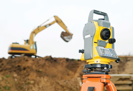
- Electronic Distance Measure – standard surveying equipments for measuring distances electronically (global positioning system or GPS, electronic total station)
Unlike before, when several surveyors were needed for the process of measuring and determining the land boundaries, today, the modern surveying technology makes the entire process much easier and less time-consuming. Each surveying tool has own advantages and disadvantages, and usually one surveying tool is used in combination with others for more accurate land measurements. The work of land surveyors depends heavily on high quality surveying equipments and tools for getting accurate and precise data about certain land.


About Author
alex
?You can always edit a bad page. You can’t edit a blank page.Likes: ❤️ Beer ?, Pizza ? Dislikes:? Mice?, Barber ?Favorite song: ? Hurts - Wonderful Life